My California - The Eagles Crest Loop
I drove up to the Mineral King area in the southern part of Sequoia national park. I snagged a permit from the ranger station and headed out for an awesome three day trek! I hit the trail up out of Mineral King valley and climbed up into White Chief valley. I spent some time exploring the old mines and tunnels and checking out old artifacts from the miners. I kept working my way up the canyon and then eventually I found a really nice spot to camp in the upper part of the canyon.
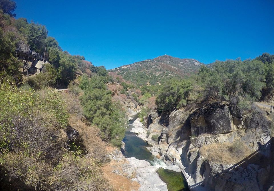 Crossing the east fork Kaweah river on the drive up to Mineral King
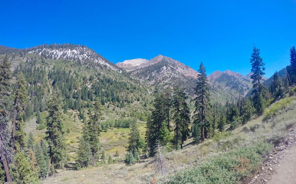 Hiking up out of Mineral King valley
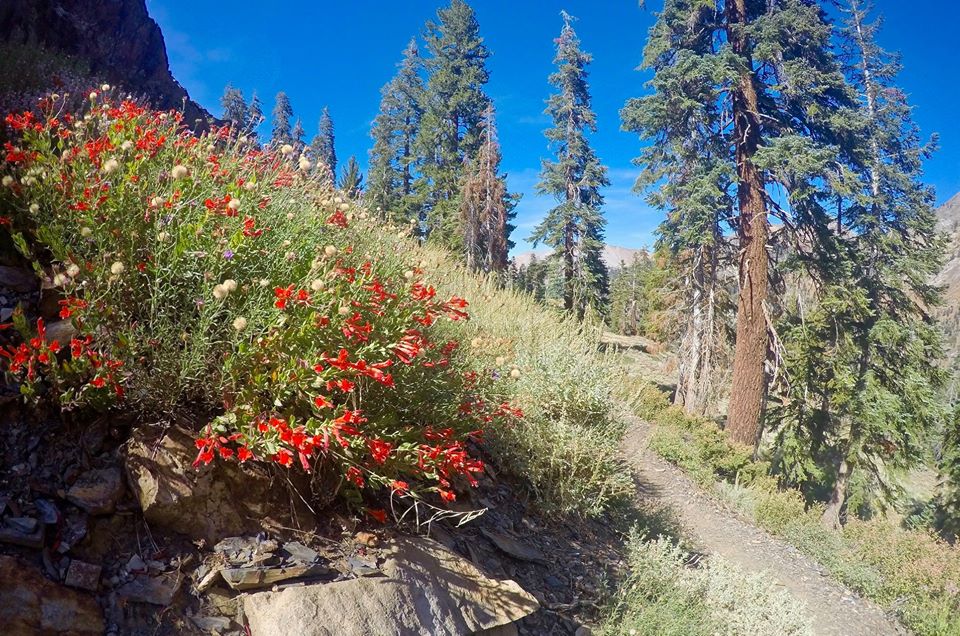 Wildflowers along the trail
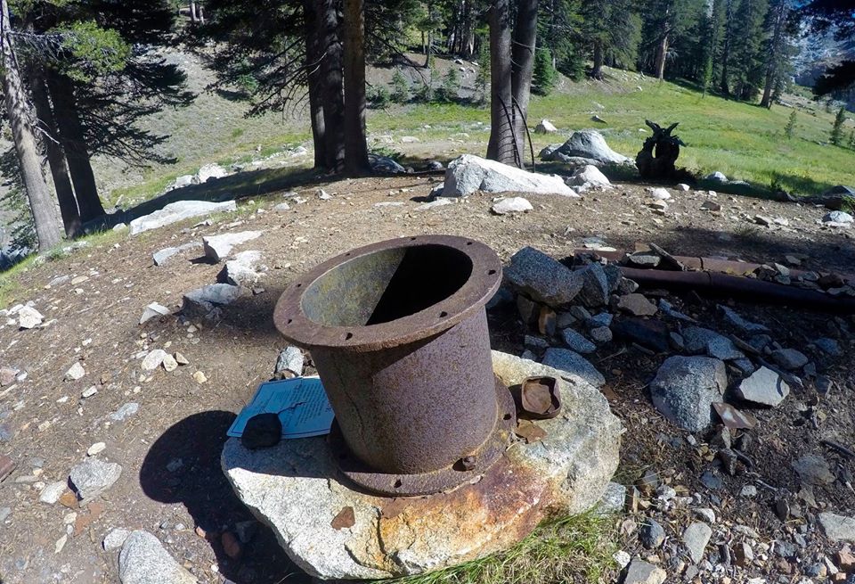 Old mining artifacts
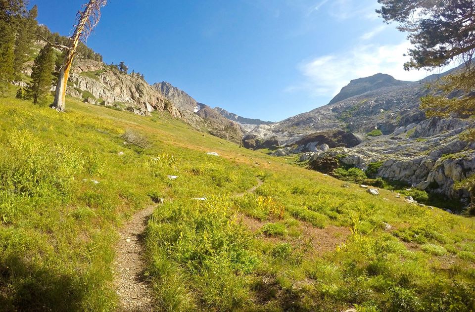 White Chief valley
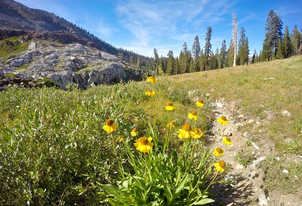 Wildflowers in White Chief valley
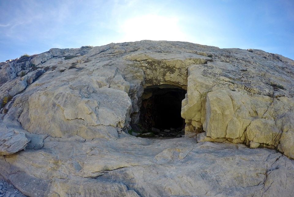 The White Chief mine
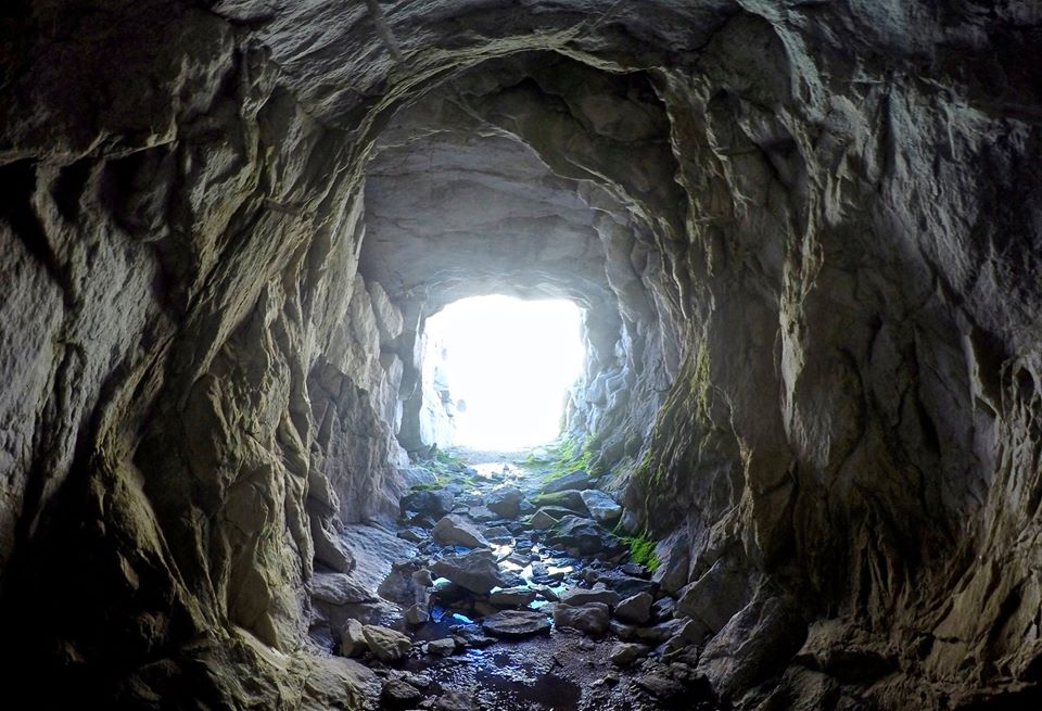 Inside the White Chief mine
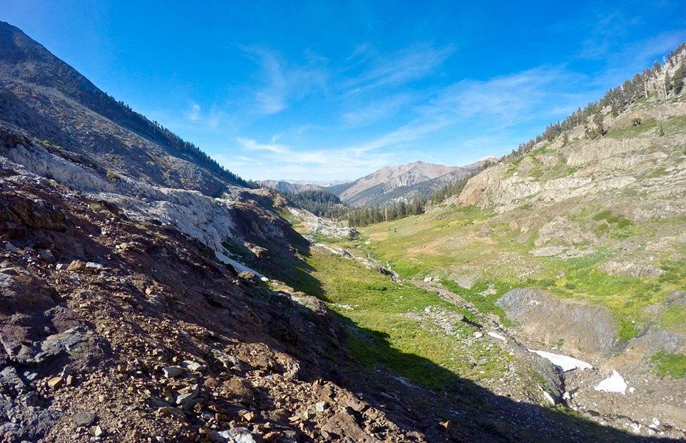 White Chief valley
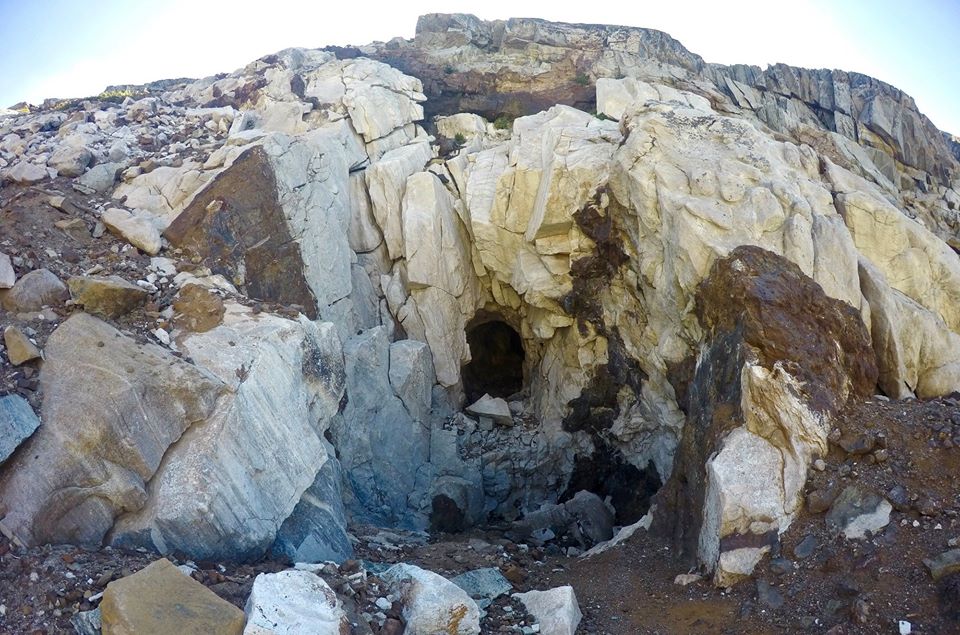 The upper mine
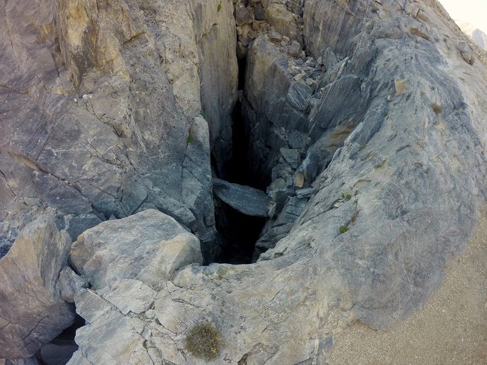 More caves
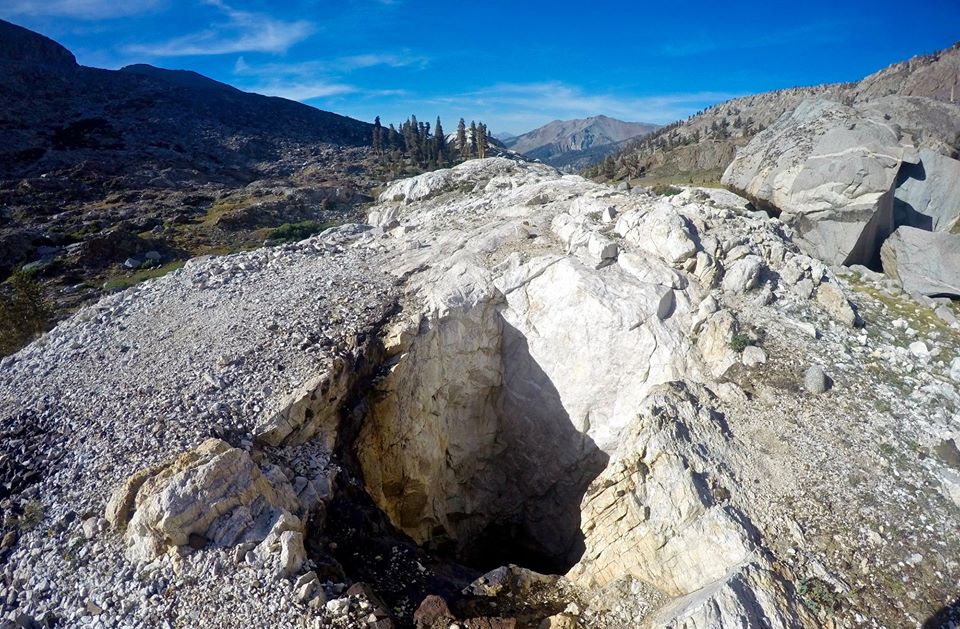 Vertical mine shaft
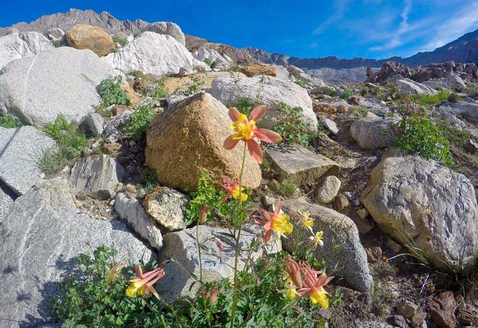 Blooming Columbine
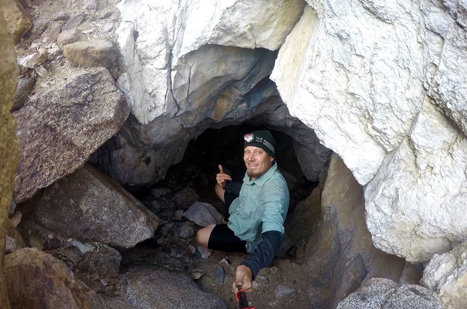 Exploring the caves
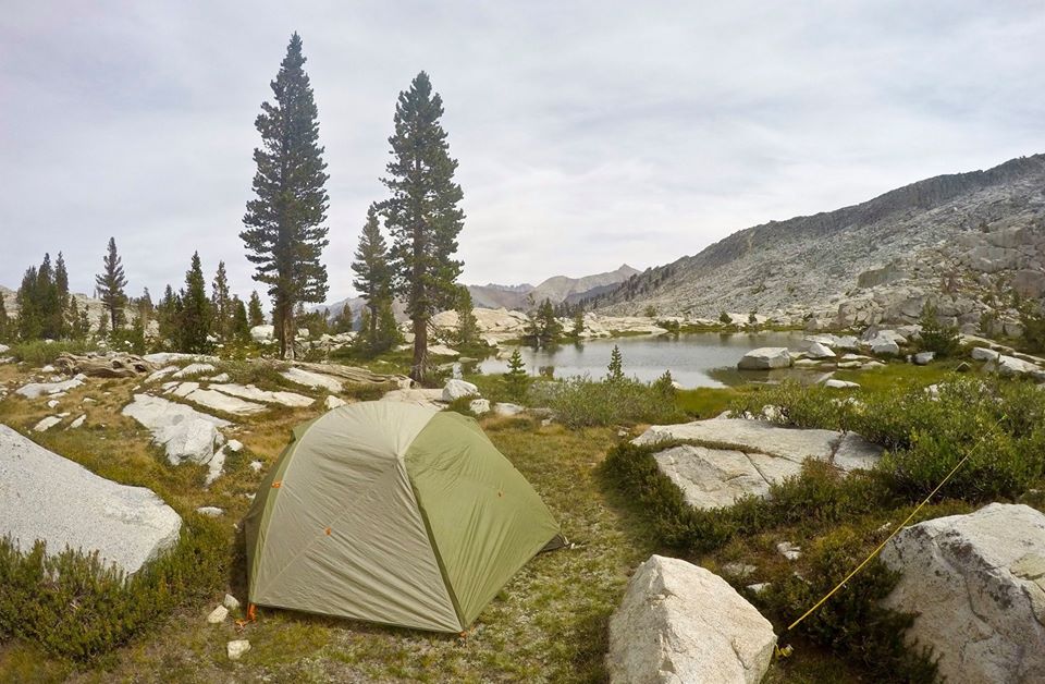
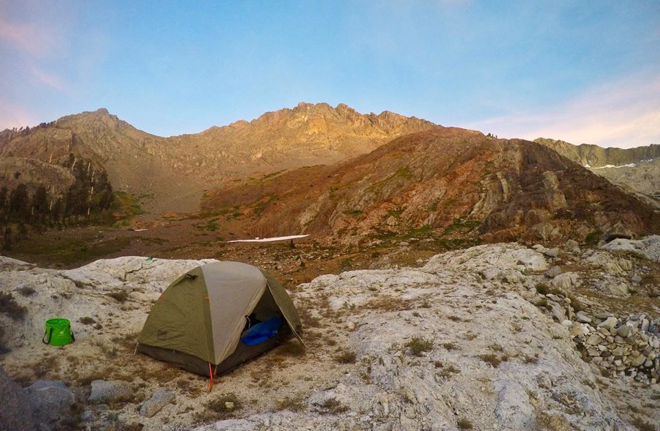 My camp
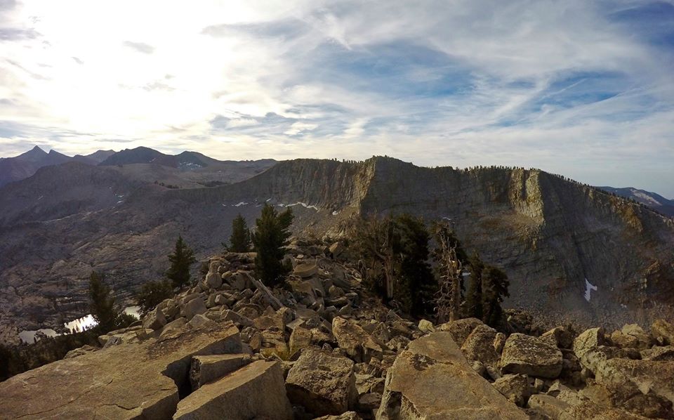
The next day I packed up my camp and started climbing up to White Chief peak(11,159'). The climb was fairly easy and the views over White Chief Valley and out to the Great Western Divide were way awesome! From there I headed down from the peak and followed along the crest of the ridge over to the top of the Eagles Crest(11,185')! It was an easy walk to the summit blocks and then there was a class 3 climb up to the summit. It wasn't too difficult, but it took a bit of route finding which made it quite fun!! I had some lunch on the summit while enjoying the views and then kept moving west . I made my way over the top of the Miners ridge and then dropped my camping gear at the saddle above the Mosquito lakes. Then I made the kinda long but really easy climb up to Hengst peak(11,146'). The views from the top were really awesome as well, but Eagles Crest definitely took the prize as best peak of the day.
 Views from White Chief peak
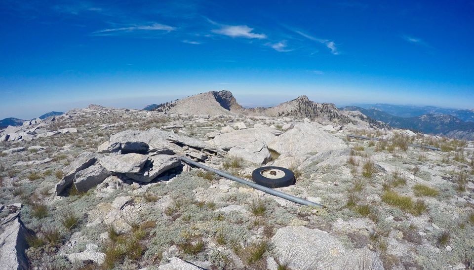 Some random artifacts along the Eagles Crest
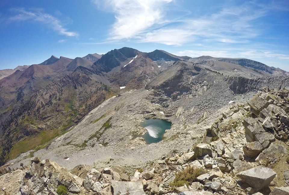 Views looking east from Eagles Crest
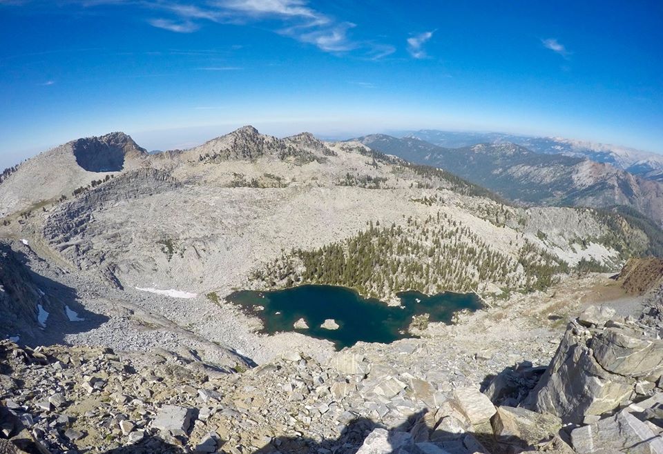 Views looking west from Eagles Crest
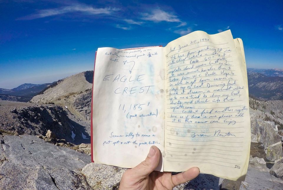 Eagles Crest summit register
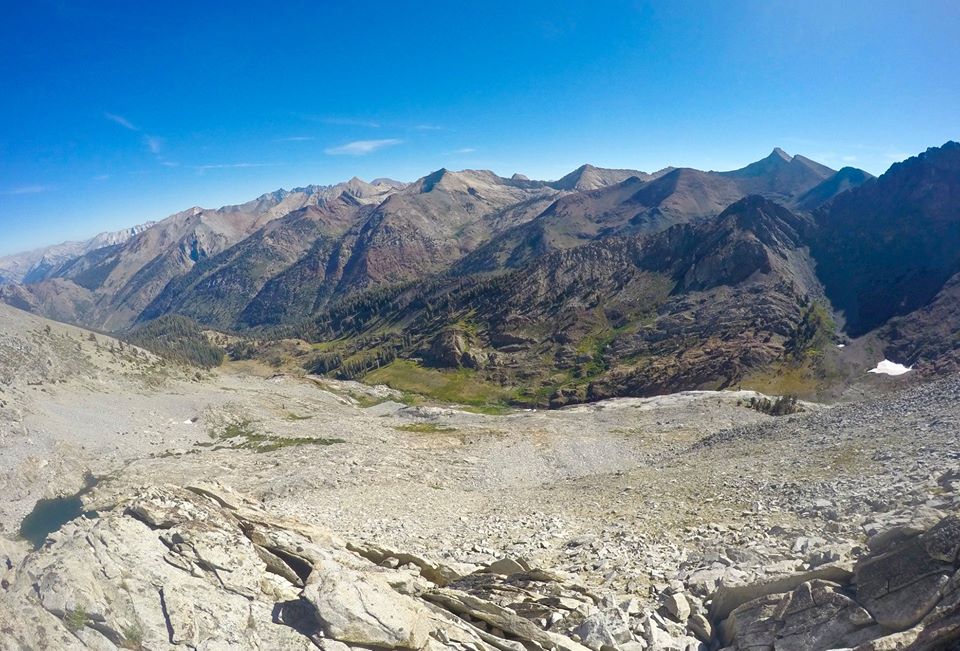
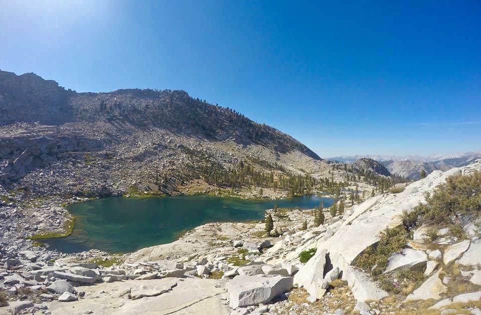
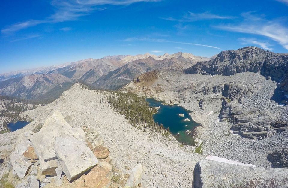 Views from the top of Miners Ridge
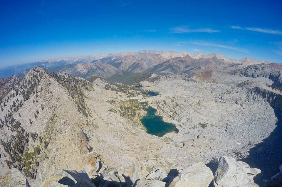 Views from Hengst peak
From Hengst peak I dropped back down to the saddle, picked up my camping gear, and headed down to upper Mosquito lake where I found a really nice camping spot on the west shore just up from the outlet. I setup my camp and spent the rest of the evening having a blast catching trout after trout after trout!!
 Overlooking upper Mosquito lake
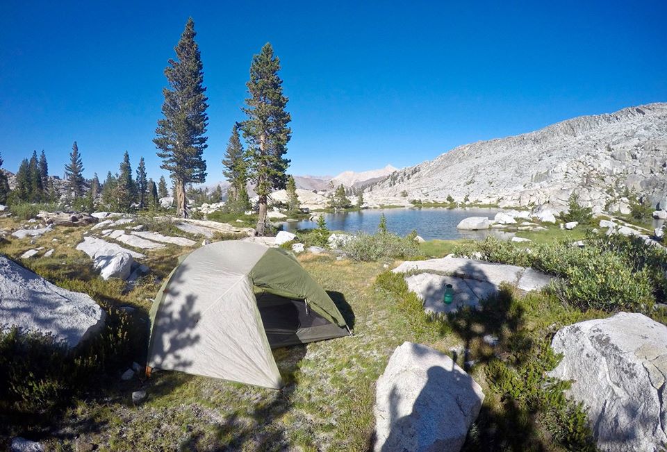 My camp
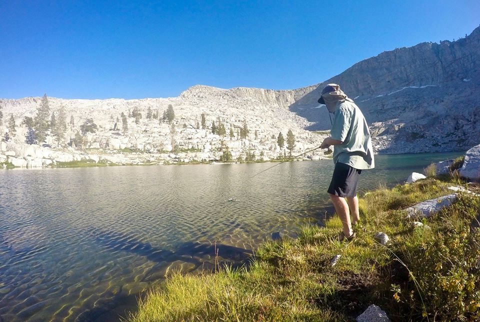 Trout fishing
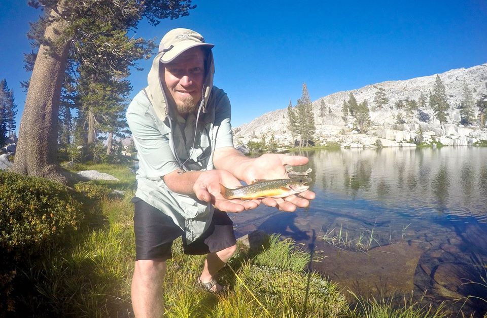 Trout fishing
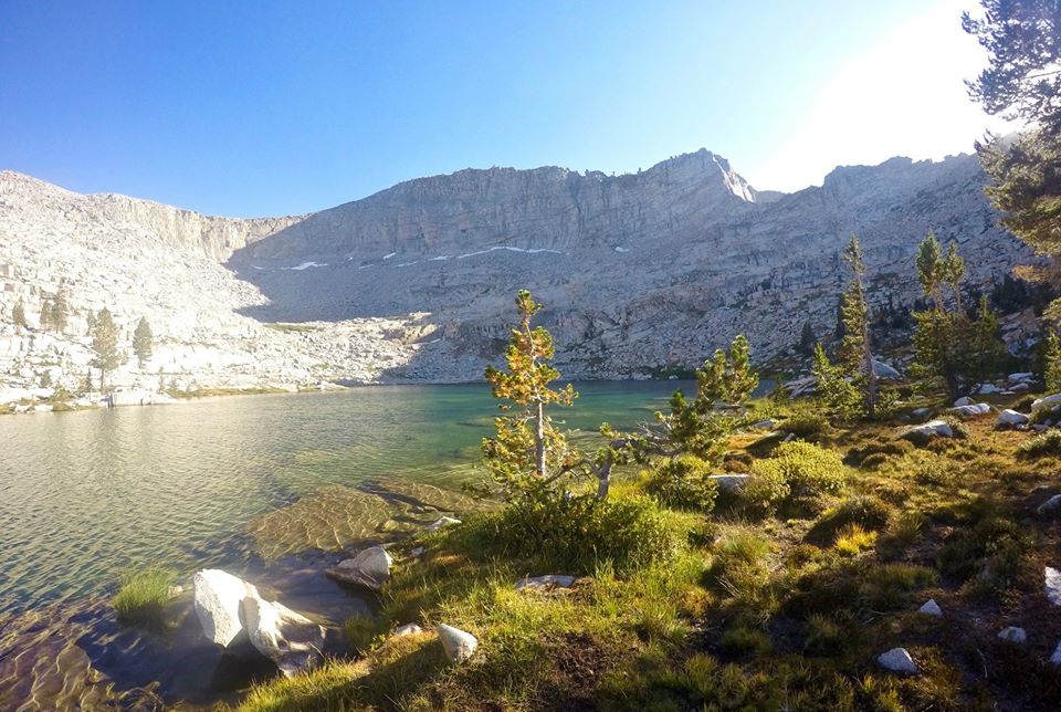 Hengst peak from upper Mosquito lake
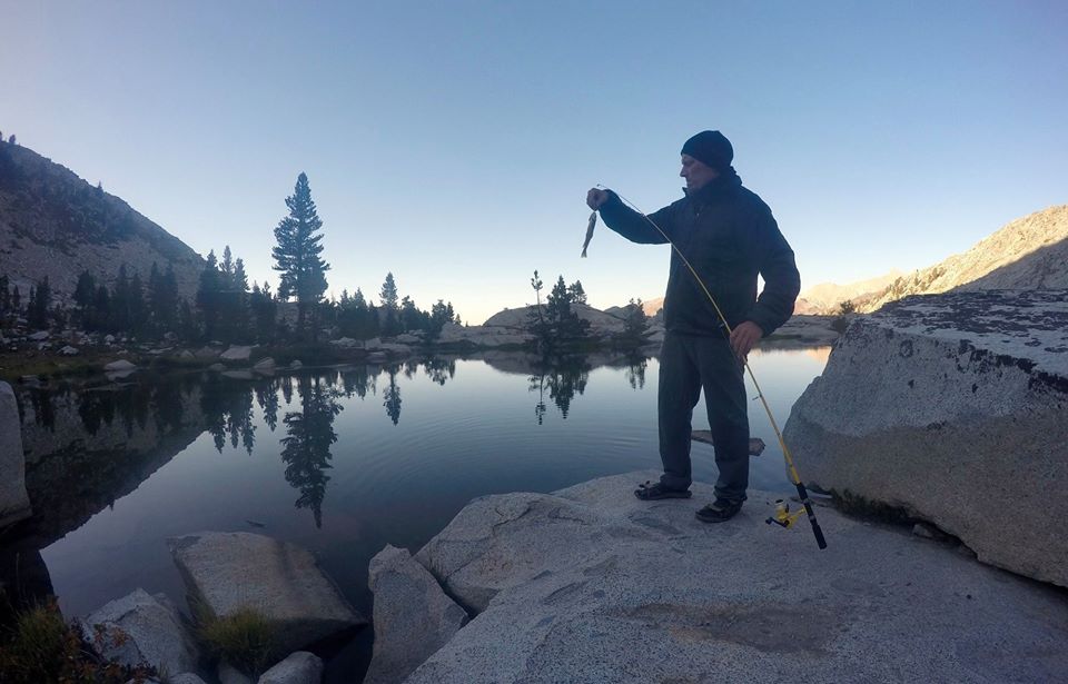 Evening fishing session
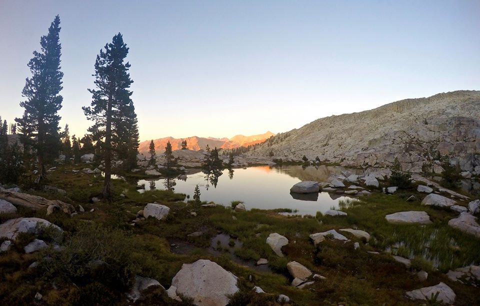 Sunset
The next morning I got up early and made the climb up to Purves Peak(11,032'). There was some brush on the route, but otherwise nothing super technical besides just being super steep and sometimes kinda loose. There were a bunch of little quartz crystals all over too, which were pretty cool to checkout. Purves had some really awesome views that definitely gave Eagle's Crest a run for it's money!
 Views looking south from Purves peak
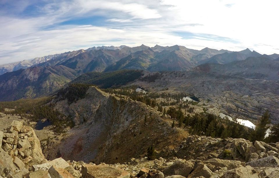 Views looking north from Purves peak
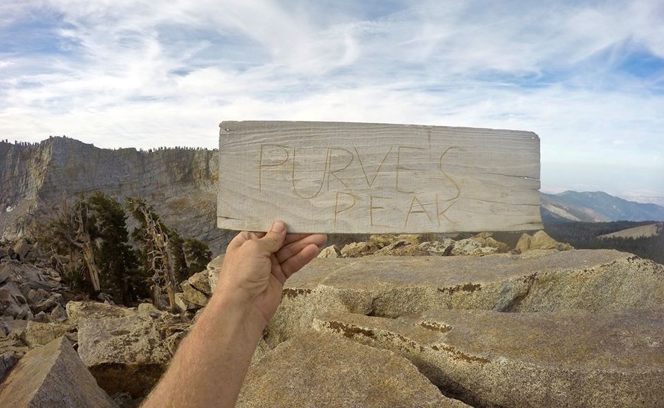 Wood sign on the top of Purves peak
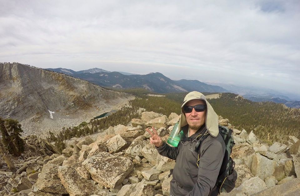 Selfie on Purves peak
After enjoying my morning on the summit I made my way back down to the lake and packed up my camp and started working my way down through the lower Mosquito lakes. From the lowest lake I caught the trail up and over the Miners Nose and then dropped back down into the Mineral King valley where I started. It was a super awesome hike... but it was just the start of this trip. I got myself a campsite at the Cold Spring campground and immediately started planning for my next adventure!
 Getting back to camp
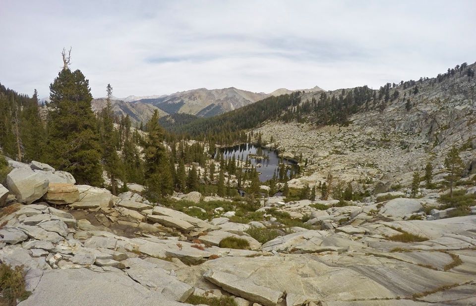 Middle Mosquito lake
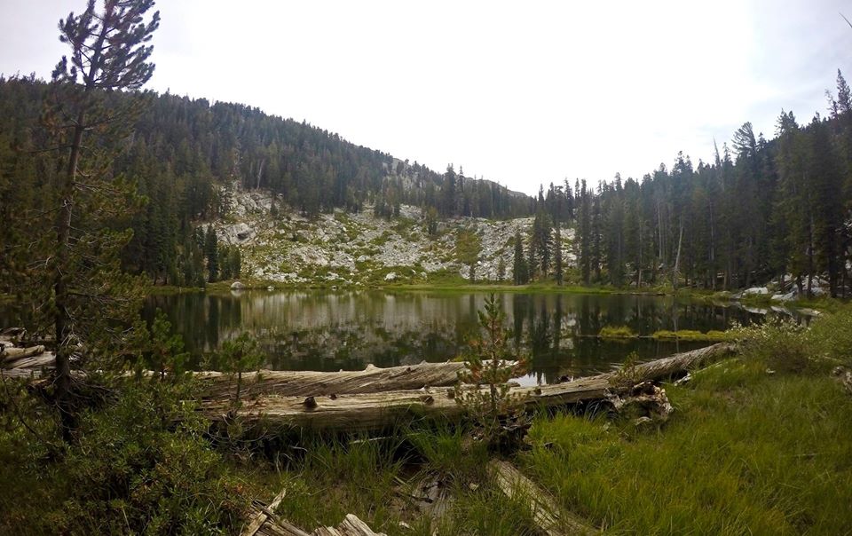 Lower Mosquito lake
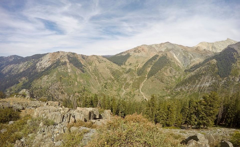 Views from the Miners Nose
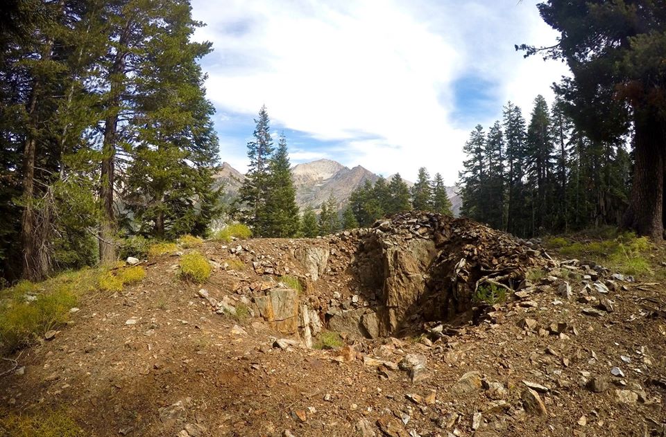 Old mining activity along the Miners ridge
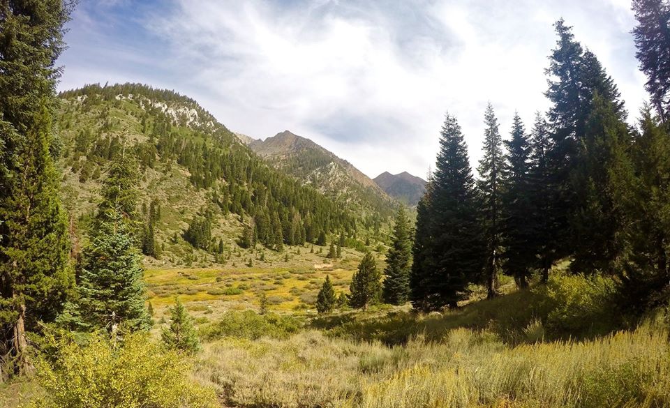 Dropping back down into Mineral King valley
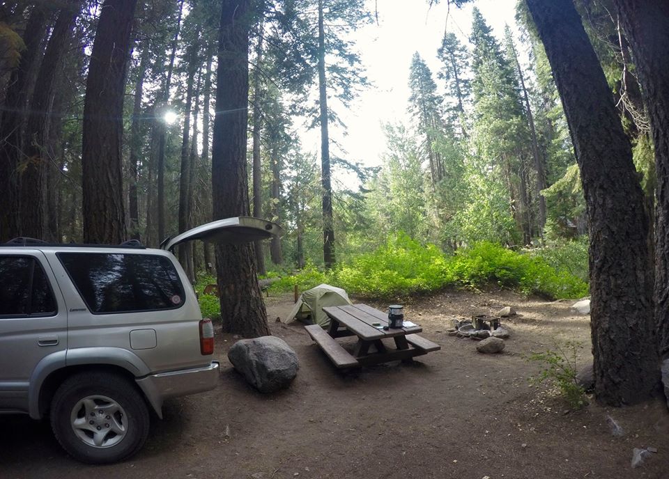 Camping at the Cold Spring campground
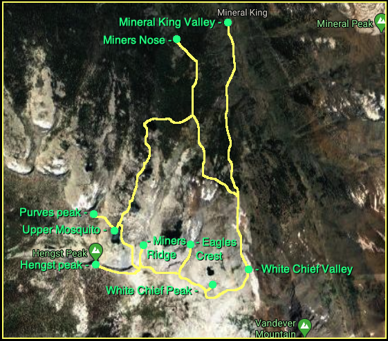 Map
MapUntil next time...
I hope you have enjoyed this glimpse into
My California!!
all photos by @derekrichardson
https://www.californiamountainadventure.com