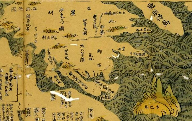
This is part of the American continent in the world map produced during the early Ming Dynasty, marked the location of today’s Canada and Cuba.
It is much more accurate than the European part which may suggest that although in the early 15th century Zheng He’s fleets never travelled to Europe but did have visited the land known as America and Canada today.
https://www.viewofchina.com/ancient-chinese-maps/
#china #map #history